Important notice: this article is for informational and educational purposes only. It does not constitute legal, financial, or insurance advice. Before purchasing or renewing flood insurance, consult a licensed insurance agent and a credentialed surveyor in Florida.
If a flood insurance bill comes in higher than expected, the high price isn’t the real problem. The real problem is that the insurer likely calculated the premium without knowing the property’s actual elevation — and without that data, insurers always default to the highest-risk scenario. One simple document, the Elevation Certificate, can change that calculation entirely.
Most homeowners assume flood insurance cost depends only on the FEMA flood zone shown on the map. In practice, within the very same flood zone, two neighboring homes can pay very different premiums — because one has an up-to-date Elevation Certificate and the other doesn’t. This article explains what this document is, how it works, and why it can represent one of the most overlooked savings in a Florida homeowner’s annual budget.
Table of Contents
- What an Elevation Certificate is
- How the Elevation Certificate affects your insurance cost
- When an Elevation Certificate is required
- How to get an Elevation Certificate
- How much an Elevation Certificate costs
- With Elevation Certificate vs. without
- Common mistakes with the Elevation Certificate
- Hidden costs of skipping the Elevation Certificate
- FAQ — Frequently Asked Questions
- 📚 Glossary
- ✅ Immediate Actions — Start Now
What an Elevation Certificate is {#what-it-is}
Short answer: an Elevation Certificate is an official FEMA document that records a structure's elevation relative to the Base Flood Elevation (BFE) for that area — the reference height used to calculate flood risk, and by extension, the cost of flood insurance.
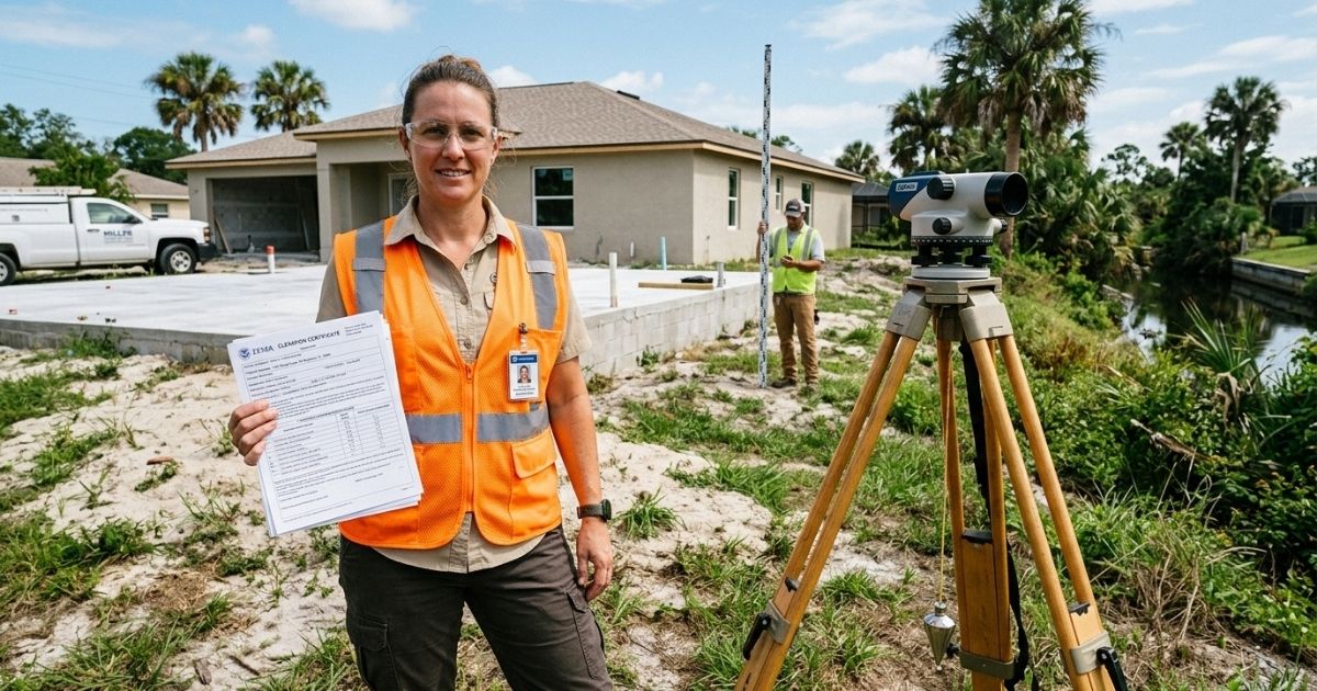
The document is completed by a licensed land surveyor or credentialed engineer, who measures specific points on the property — such as the lowest habitable floor, the foundation, and mechanical equipment — and compares those measurements against the base flood elevation established by FEMA for that location.
The result is a standardized form (FEMA Form 086-0-33) that shows, in precise numbers, how far the property sits above or below the expected flood level. That difference, measured in feet, is exactly the data insurers use to recalculate a property’s real risk instead of relying on the generic flood zone classification alone.
How the Elevation Certificate affects your insurance cost {#how-it-affects}
Short answer: without an Elevation Certificate, insurers apply a default rate that assumes the worst-case scenario within the flood zone; with the document, the premium is calculated based on the property's actual elevation, which can significantly reduce the amount paid every year.
Under the National Flood Insurance Program (NFIP), premium calculations factor in the difference between a home’s lowest floor elevation and the Base Flood Elevation for the area. The higher the structure sits above that level, the lower the calculated risk tends to be — and the lower the premium.
Without an Elevation Certificate, the insurer doesn’t have that specific data point and must assume a conservative elevation, generally the least favorable one allowed within the flood zone. This means:
- A home that, in reality, sits well above the flood level may end up paying as if it were at the minimum acceptable elevation.
- Two neighboring properties in the same flood zone can carry very different premiums simply because one submitted the certificate and the other didn’t.
- The annual difference can add up to hundreds, or in some cases thousands, of dollars — depending on the flood zone and the structure’s actual elevation.
FEMA’s Risk Rating 2.0 system also factors in multiple risk variables beyond elevation, but elevation remains one of the most decisive data points when it’s available.
When an Elevation Certificate is required {#when-required}
Short answer: an Elevation Certificate is typically required for financed properties in high-risk flood zones (zones A and V), for new construction or substantial improvements within those zones, and for homeowners looking to challenge or reduce an existing flood insurance premium.
Not every homeowner is required to have this document, but it becomes necessary — or strongly advisable — in specific situations:
- Financing in a high-risk flood zone. Lenders frequently require the certificate as part of the property’s risk assessment.
- New construction or substantial improvement within a Special Flood Hazard Area (SFHA), when the county requires proof of compliance with elevation codes.
- Flood zone disputes (Letter of Map Amendment), when a homeowner believes the property was classified incorrectly.
- Voluntary premium review, when a homeowner simply wants to check whether the actual elevation justifies a lower rate than what’s currently being charged.
Homeowners outside high-risk flood zones, or those who financed a property without the certificate being required, can also request one independently — the document doesn’t require prior county approval to be ordered.
How to get an Elevation Certificate {#how-to-get}
Short answer: an Elevation Certificate must be requested directly from a licensed land surveyor or engineer in Florida, who visits the property, performs the required measurements, and issues the official signed and sealed form.
The process generally follows these steps:
- Hire a licensed surveyor in Florida with specific experience issuing Elevation Certificates — not every land survey includes this measurement by default.
- Schedule the site visit, during which the professional measures the elevation of the lowest floor, the foundation, and relevant mechanical equipment.
- Receive the completed and signed form, which must be certified (sealed) by the responsible professional.
- Submit the document to your insurer, who recalculates the premium based on the data provided.
The time between hiring a surveyor and receiving the final document typically ranges from a few days to a few weeks, depending on the professional’s availability and the complexity of the property.
How much an Elevation Certificate costs {#how-much}
Short answer: an Elevation Certificate in Florida typically costs a few hundred dollars, depending on the property's location, site access, and structural complexity — an expense that, in most cases, pays for itself quickly through the resulting reduction in insurance premiums.
The final price depends on factors such as:
- Property location — more remote or hard-to-access areas can cost more.
- Structure type — elevated homes (on stilts or piers) or complex foundations may require additional measurement points.
- Service urgency — rush requests may carry an additional fee.
- Availability of prior documentation — if a recent survey already exists for the property, the process can be faster and cheaper.
Before hiring, it’s worth comparing quotes from at least two or three licensed surveyors in the area, checking references and specific experience with Elevation Certificates — not just general land surveys.
With Elevation Certificate vs. without {#comparison-table}
| Aspect | With Elevation Certificate | Without Elevation Certificate |
|---|---|---|
| Premium calculation basis | Actual measured elevation of the structure | Conservative worst-case scenario assumed by the insurer |
| Typical premium | Can be significantly lower if the elevation is favorable | Tends to reflect the worst case within the flood zone |
| Financing in a high-risk flood zone | Generally accepted without added friction | May trigger additional lender requirements |
| Flood zone dispute | Essential document for the process | Dispute isn't possible without elevation data |
| Resale of the property | Simplifies negotiation and insurance transfer | Buyer may require the document before closing |
Common mistakes with the Elevation Certificate {#common-mistakes}
Short answer: the most common mistakes include assuming the certificate is only necessary outside high-risk zones, hiring a professional without specific experience with the FEMA form, and failing to update the document after renovations or changes to the property's foundation.
- Assuming only zone A or V properties need the document. Even in moderate-risk zones, the certificate can lower a premium or prove useful in a future flood zone dispute.
- Hiring the wrong professional. Not every land surveyor has specific experience with FEMA Form 086-0-33 — confirm this before booking the service.
- Not updating it after renovations. Changes to the foundation, elevation of mechanical equipment, or structural remodels can alter the certificate’s data and should be reflected in a new filing.
- Not submitting the document to the insurer properly. The certificate only generates savings once it’s formally submitted and processed by the insurance company — filing it away without submitting it won’t change the premium.
- Leaving the buyer without the document at sale. A valid Elevation Certificate simplifies the insurance transfer to the new owner and speeds up closing.
Hidden costs of skipping the Elevation Certificate {#hidden-costs}
Short answer: skipping an Elevation Certificate can mean years of paying higher-than-necessary insurance premiums, missing the chance to dispute an incorrect flood zone, and facing delays during financing or resale.
- Higher accumulated premiums over the years, unnecessarily, when the actual elevation would justify a lower rate.
- Inability to dispute a flood zone classification that may be outdated or incorrect for the specific property.
- Delays in the financing process, when the lender requires the document and the owner has to scramble to request it last minute.
- Weaker negotiating position at sale, when the buyer requires the certificate as a condition to move forward with the purchase.
None of these costs show up on the insurance bill itself — they all show up over time, less visibly, but just as real.
FAQ — Frequently Asked Questions {#faq}
Does an Elevation Certificate guarantee lower insurance?
Not necessarily. The document gives the insurer accurate data to calculate the property’s real risk — if the property sits well above the base flood elevation, the premium tends to drop; if it’s at or below the minimum level, the cost may stay the same or even increase.
Who can issue an Elevation Certificate in Florida?
Only a licensed land surveyor or engineer in the state of Florida can measure, complete, and certify the official FEMA form.
Does vacant land need an Elevation Certificate?
Generally not, since the document measures the elevation of a built structure. Vacant land is typically assessed differently for flood risk, without requiring this specific certificate.
Does an Elevation Certificate expire or need renewal?
The document doesn’t carry an automatic expiration date, but it should be updated whenever there are relevant structural changes, such as foundation renovations or elevated mechanical equipment.
Can I use the seller’s Elevation Certificate when buying a property?
In many cases, yes — as long as the document accurately reflects the property’s current condition. It’s still worth confirming with your insurer and requesting an updated verification if needed.
📚 Glossary {#glossary}
Elevation Certificate — an official FEMA document that records a structure’s elevation relative to the base flood elevation, used to calculate flood insurance risk and premiums.
Base Flood Elevation (BFE) — the reference height established by FEMA for a given area, used as the benchmark for measuring a property’s flood risk.
Flood zone — a risk classification assigned by FEMA to a specific area, based on officially updated flood maps.
National Flood Insurance Program (NFIP) — the federal program that administers most flood insurance policies in the United States.
Special Flood Hazard Area (SFHA) — an area classified by FEMA as high-risk for flooding, generally corresponding to zones A and V on official maps.
Letter of Map Amendment (LOMA) — a formal request to correct a property’s flood zone classification, based on updated elevation data.
✅ Immediate Actions — Start Now {#immediate-actions}
- Check your property’s current flood zone on FEMA’s official map
- Confirm with your insurer whether your current premium was calculated with or without an Elevation Certificate
- Request quotes from at least two licensed surveyors with specific experience in FEMA Form 086-0-33
- Once you receive the document, submit it formally to your insurer for premium recalculation
- Keep a copy of the Elevation Certificate with your property records for future financing or resale
- Talk to TerraNoble for bilingual guidance on documentation and property costs in Florida
Conclusion
An Elevation Certificate isn’t just another piece of paperwork — it’s often the difference between paying a flood insurance premium calculated on the worst-case scenario and paying a rate that reflects your property’s actual elevation. For many Florida homeowners, the cost of requesting the certificate pays for itself within a few years, or even in the first year, depending on the savings generated.
TerraNoble offers bilingual support — in English and Portuguese — for Latin American investors looking to understand the real documentation and costs of owning property in Florida, helping identify savings opportunities like this one before they go unnoticed.